The Haast Pass corridor is one of the most spectacular stretches of road in New Zealand — a UNESCO World Heritage route that crosses the Southern Alps at 562 metres above sea level, connecting the West Coast to the Otago interior through a landscape of extraordinary geological and ecological drama. State Highway 6 threads through the Haast Pass following the Haast River valley, passing beneath near-vertical mountain walls draped in mossy beech forest, across swing bridges over turquoise-green rivers, and beside waterfalls that drop from invisible heights in the cliffs above. The road descends eastward from the pass into the wide, braided Haast River plain before climbing again through the gorge toward the Blue Pools and eventually opening to the broad tussock expanse of the Otago interior and the shores of Lake Wānaka. The entire drive from Haast township to Wānaka takes approximately two hours without stops — but the density of stopping points along the route means a leisurely half-day is more realistic.
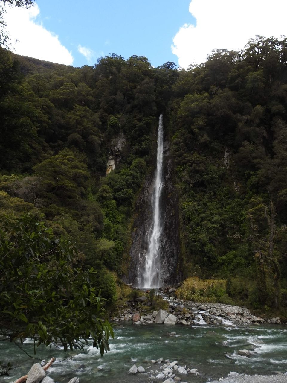
Thunder Creek Falls
Thunder Creek Falls is one of the most dramatically situated waterfalls in New Zealand — a single unbroken plunge of approximately 96 metres dropping from the cliff edge of the Haast Pass valley wall directly into the Haast River below. The waterfall is fed by snowmelt and rain from the névé fields above, and runs year-round, varying in volume with rainfall. What makes it visually arresting is the setting: the falls emerge from the dense beech forest at the top of a sheer rock face with no warning, dropping in a thin white column through clear air to a rocky fan of boulders at the river’s edge, where the turbulence sends mist drifting across the water. A short walk from the State Highway 6 car park leads to the base viewpoint — the scale of the drop becomes apparent only from here, where the cliff top is barely visible through the forest canopy above.
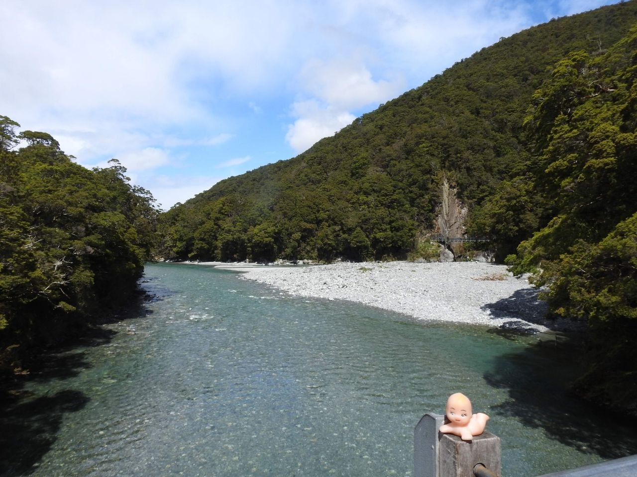
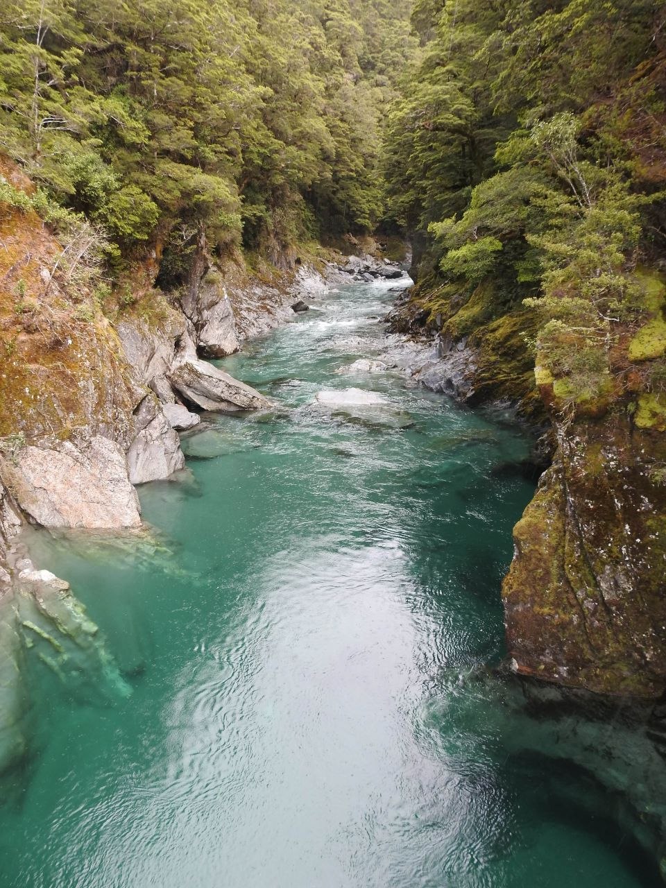
The Blue Pools
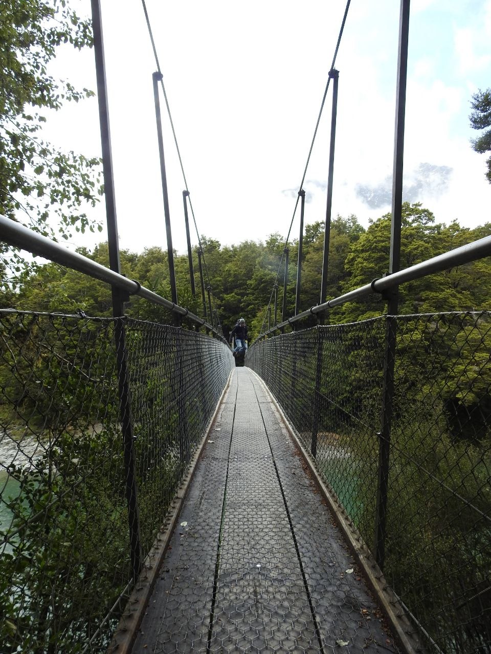
The Blue Pools are a series of glacially fed pools on the Makarora River, located within the Mount Aspiring National Park just east of the Haast Pass summit. The pools take their name from the extraordinary colour of the water — a deep, clear teal-green produced by the combination of glacial flour suspended in the water, the depth of the pools, and the refraction of light through the surrounding beech forest canopy. A well-formed track from the State Highway 6 car park leads through mature red and silver beech forest to the river, crossing it via a swingbridge suspended above the gorge — the view from the bridge looking upstream reveals the pools in their full depth, the water colour shifting from pale green at the shallows to near-black in the deepest sections of the channel. The rock walls of the gorge below the bridge are heavily moss-covered, the water threading between smooth schist boulders at the base. A second, smaller cascade waterfall is visible upstream from the river shingle banks beside the pools.
Lake Wānaka
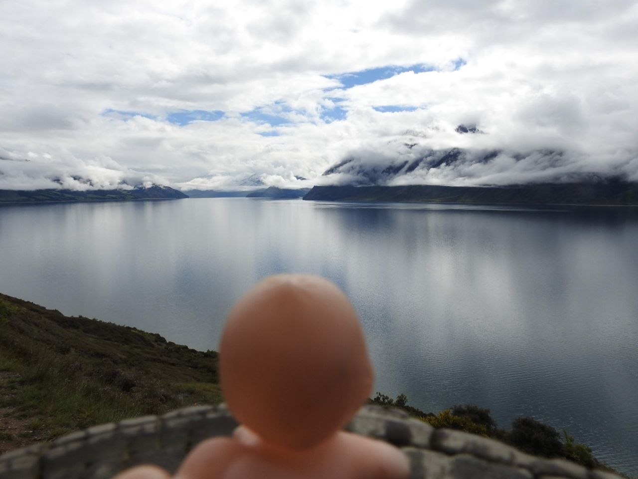
Lake Wānaka is a deep glacial lake at the northern edge of the Otago region, covering approximately 192 square kilometres at an elevation of 278 metres above sea level. It is the fourth-largest lake in New Zealand, formed by glacial action during the last ice age and drained today by the Clutha River — New Zealand’s largest river by volume — at its southern end. The lake sits in a basin surrounded on three sides by the ranges of the Southern Alps and the Harris Mountains, their peaks rising to over 2,000 metres and frequently capped with snow year-round. Viewed from the elevated tussock slopes above the southern shore, the lake presents a surface of remarkable stillness on calm days — a perfect grey-silver mirror reflecting the cloud formations above, its far shores receding into low cloud and mountain silhouette. The township of Wānaka, at the lake’s southern end, is a small resort town and the gateway to Mount Aspiring National Park.
Visiting Tips
The Haast Pass is traversed on State Highway 6 between Haast township on the West Coast and Wānaka in Otago — a drive of approximately 145 kilometres. The road is paved throughout but narrow in places, with one-lane sections at swing bridges; drive slowly and give way to oncoming traffic on the bridges. Thunder Creek Falls is signed from the highway with a small car park on the true right (west) bank of the Haast River — the viewpoint is a 5-minute walk from the road. The Blue Pools car park is located approximately 7 kilometres east of the Haast Pass summit, also signed from the highway; the walk to the swingbridge and pools takes approximately 30–40 minutes return on a well-graded track. The swingbridge can be crossed one direction at a time. The lake viewpoint above Wānaka is accessible from several points on the road descending from Haast Pass — pull-offs on the true left of the road offer the best elevated perspectives. Wānaka township has a full range of accommodation, dining, and activity operators, and makes a good base for exploring Mount Aspiring National Park.

Leave a comment