Franz Josef Glacier (Kā Roimata o Hine Hukatere in Māori — “the tears of Hine Hukatere”) is one of the most accessible and visually dramatic glaciers in the world, descending from the Southern Alps of New Zealand’s South Island to within 240 metres of sea level on the West Coast. The glacier flows from a high névé field through a steep, narrow valley carved into the Westland Tai Poutini National Park — a UNESCO World Heritage area — reaching a terminal face that once extended to the valley floor but has retreated significantly in recent decades due to climate change. What makes Franz Josef extraordinary is its setting: the glacier pushes through a gorge of near-vertical schist and granite walls, its lower flanks fringed by temperate rainforest draped in moss and ferns, with waterfalls spilling down the valley sides from the surrounding peaks. The combination of ancient ice and lush jungle within a few hundred metres of each other is found almost nowhere else on earth at this latitude.
The Glacier: Ice, Crevasses & Seracs
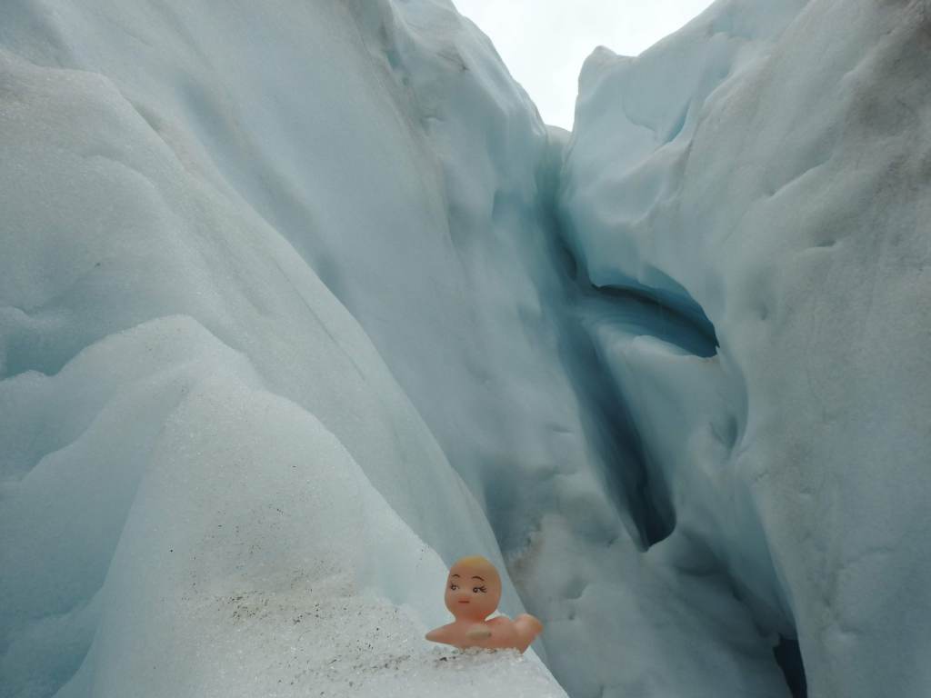
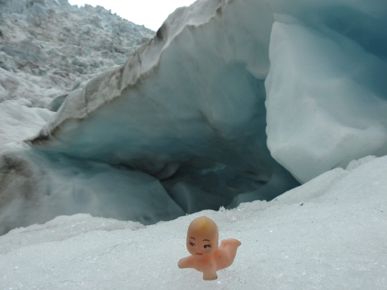
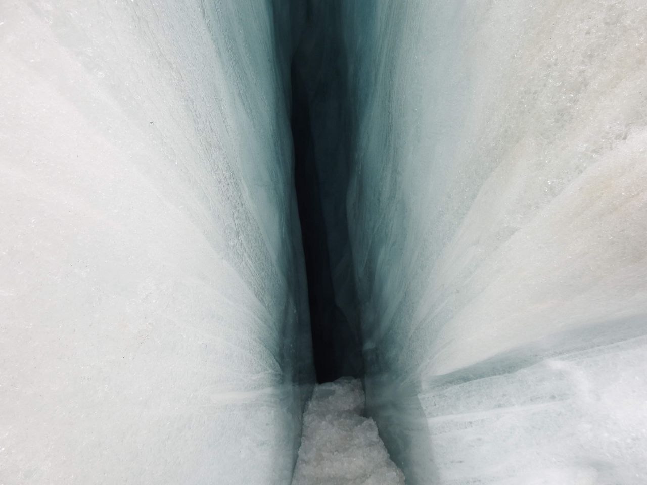
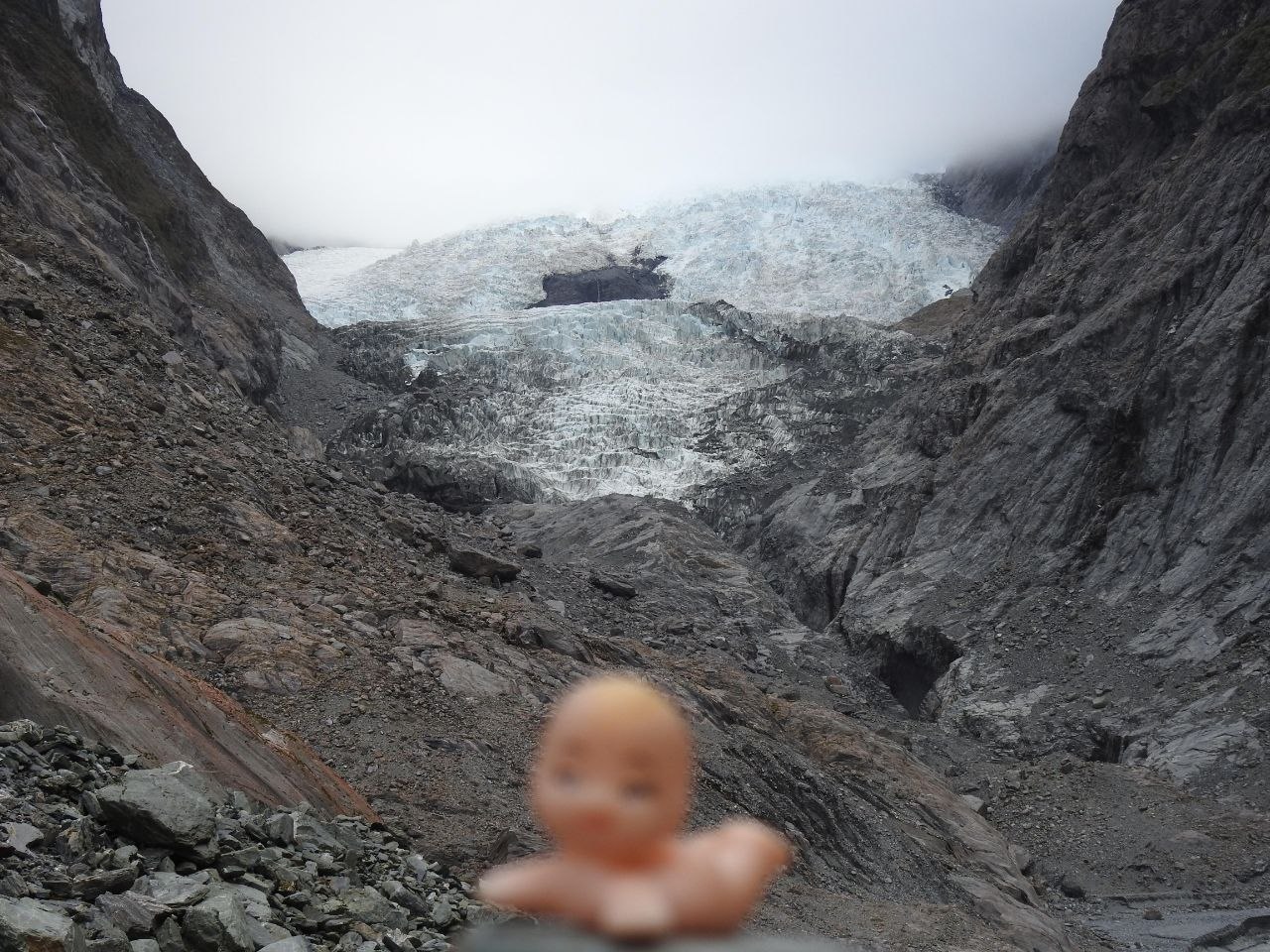
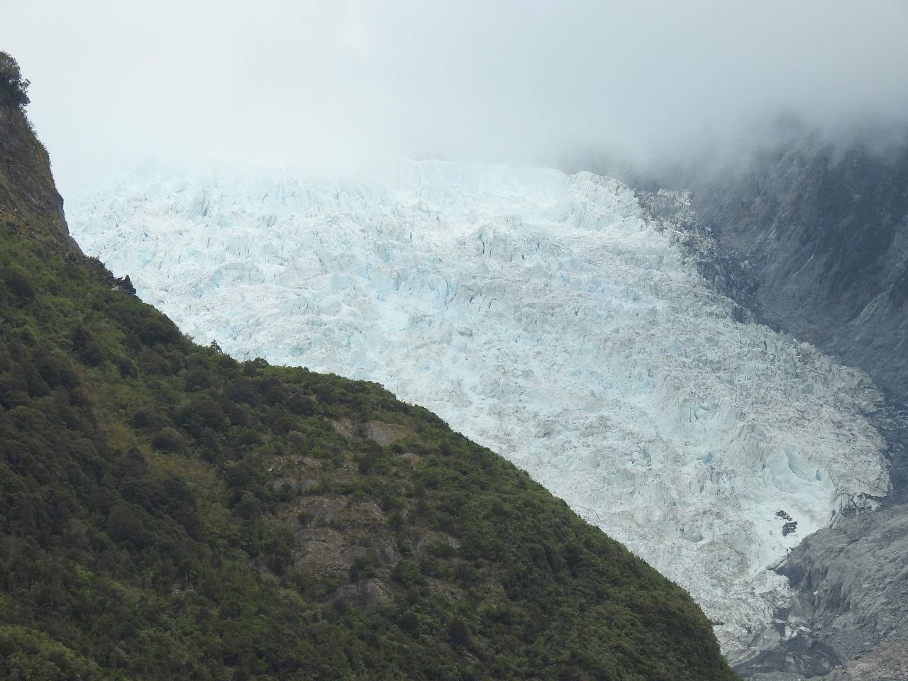
Franz Josef is a temperate glacier — meaning it exists at or near the pressure melting point throughout its depth, making it unusually dynamic and fast-moving compared to polar glaciers. At its peak flow rate it has been measured advancing several metres per day. The upper glacier is a chaotic landscape of seracs (towers and blocks of ice formed where the glacier flows over steep underlying bedrock), deep crevasses, and meltwater channels. Crevasses in the upper ice can extend many metres deep — the walls revealing layers of compacted snow and ice in shades of white, grey, and the deep, otherworldly blue that results from the absorption of red light wavelengths in dense glacial ice. Meltwater percolates through the ice to form englacial channels and mill holes, eventually emerging at the glacier’s snout as the Waiho River — a braided, milky-white glacial stream carrying fine rock flour ground from the valley walls by the glacier’s movement. The terminal face of the glacier, viewed from the valley floor lookout or from above by helicopter, presents an extraordinary wall of fractured seracs, blue ice voids, and angular collapse features — a constantly changing structure that calves and shifts as the glacier moves and melts.
Heli-Hiking on the Ice
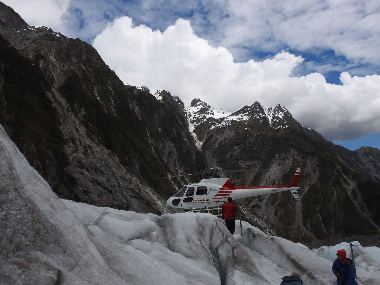
Access to the upper glacier is by helicopter — the only way to reach the ice safely given the extent of the glacier’s retreat from the valley floor. Operators fly small groups from the Franz Josef village helipad, ascending rapidly up the valley before touching down on a flat section of the upper glacier. The helicopters land directly on the ice, and passengers step out onto the surface in crampons and waterproof gear provided by the operator. The heli-hike experience gives direct access to the glacier’s surface: guides lead small groups through the ice, into crevasses, past serac towers, and into meltwater features with walls of luminous blue glacial ice. The scale becomes apparent only up close — features that appear small from the air resolve into walls and caverns several metres high. The sound environment on the glacier is striking: the crunch of crampons on ice, the drip and trickle of meltwater, and occasional deep groans or cracks from within the ice as the glacier shifts.
The Valley & Rainforest
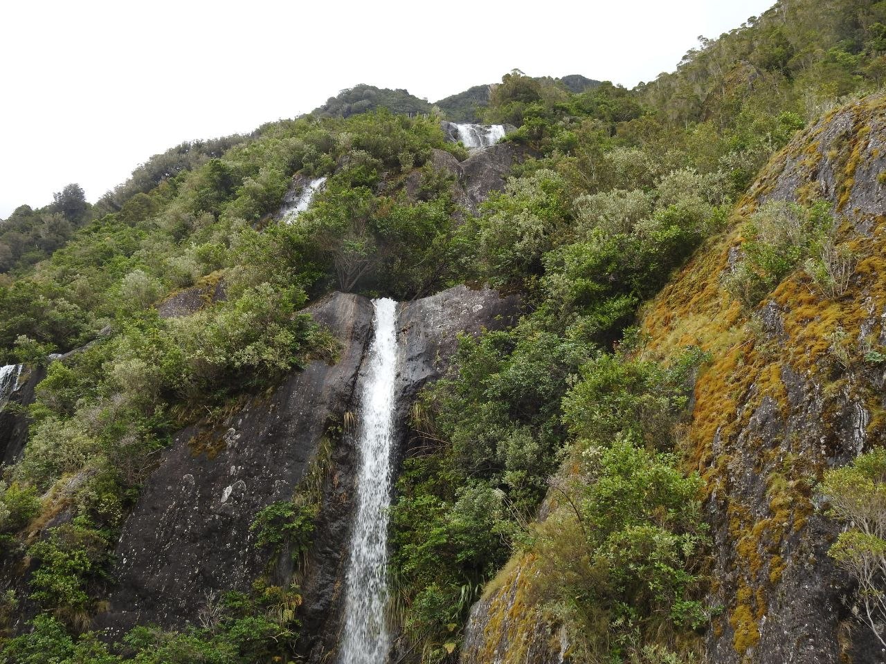
The Waiho Valley that contains Franz Josef Glacier is one of the most geographically compressed environments in the world: within a few kilometres, the landscape transitions from sub-alpine moraine and bare rock scoured by the retreating glacier to dense temperate rainforest of rimu, kāmahi, and tree ferns draped in mosses and liverworts. Waterfalls cascade down the valley walls on both sides — fed by the high rainfall of the West Coast, which exceeds five metres annually in parts of the park, and by meltwater from the névé fields above. The valley floor walking tracks (currently accessed from a point several kilometres below the former glacier terminal) pass through this rainforest fringe, with the glacier visible at the head of the valley between its rock walls — a vertical compression of ecosystems that is one of Westland’s defining visual experiences.
Visiting Tips
Franz Josef village is located on State Highway 6 on the West Coast of the South Island, approximately 4 hours by road from Queenstown and 4.5 hours from Christchurch. The nearest airport with scheduled services is Hokitika (HKK), connected by Sounds Air from Wellington and Nelson, or Queenstown (ZQN) for onward road travel. Heli-hiking tours operate weather permitting — the West Coast is notoriously changeable and tours are frequently cancelled or rescheduled due to cloud. Book as early in your stay as possible to allow flexibility for rebooking. Multiple operators offer heli-hikes from the village; tours typically last 3–4 hours including the flight and guided time on the ice. Crampons, waterproof jackets, and gaiters are provided; wear warm layers and sturdy footwear underneath. The valley floor walk to the glacier viewpoint is free and takes approximately 1–1.5 hours return — the glacier face is visible but distant. Fox Glacier, approximately 24 kilometres to the south, offers a similar experience and is worth visiting on the same trip if time allows.

Leave a comment