Cajas National Park is a high-altitude protected area located approximately 30 kilometres west of Cuenca in the Azuay Province of Ecuador. Covering around 28,544 hectares, the park spans elevations from roughly 3,150 to 4,450 metres above sea level and is characterised by its extraordinary concentration of lakes — more than 200 glacially formed lagoons scattered across an undulating landscape of páramo grassland, rocky ridgelines, and cloud forest valleys. The park is also a critical water source for the city of Cuenca and was designated a UNESCO Biosphere Reserve in 2013.
The Lakes
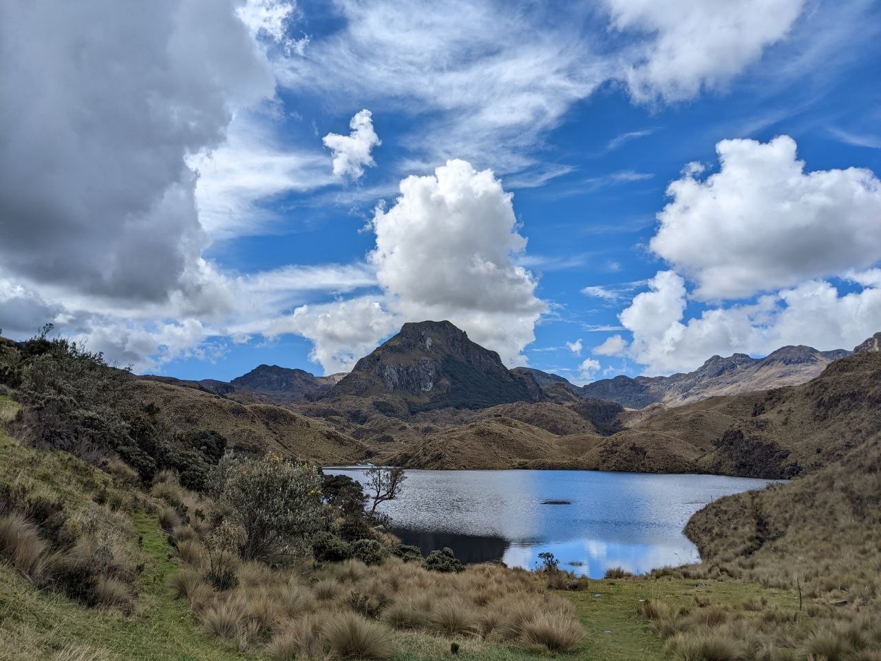
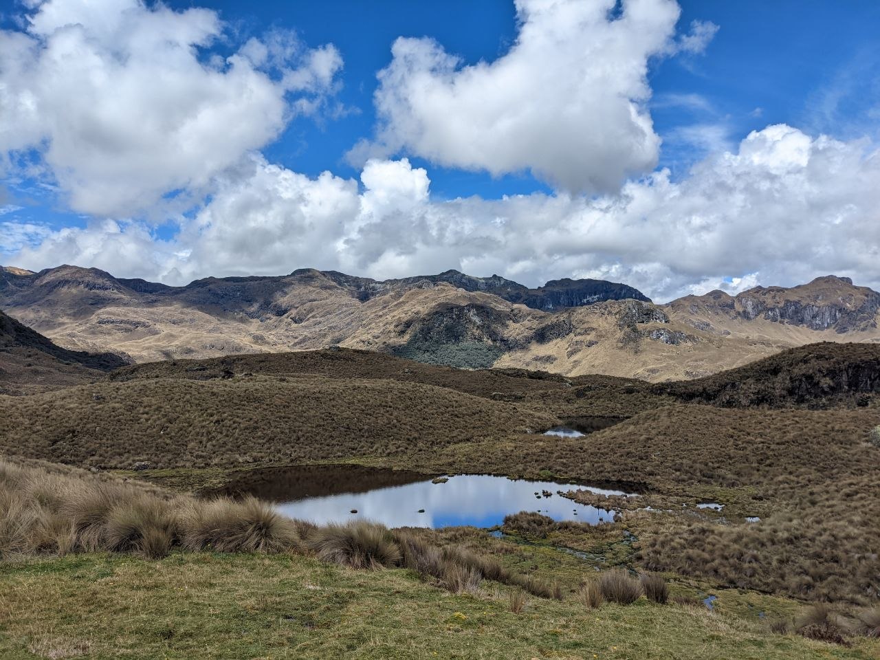
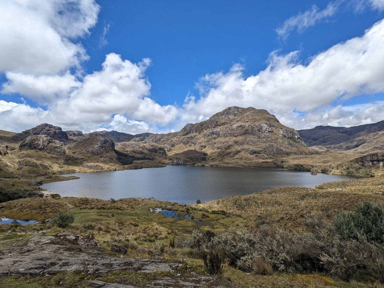
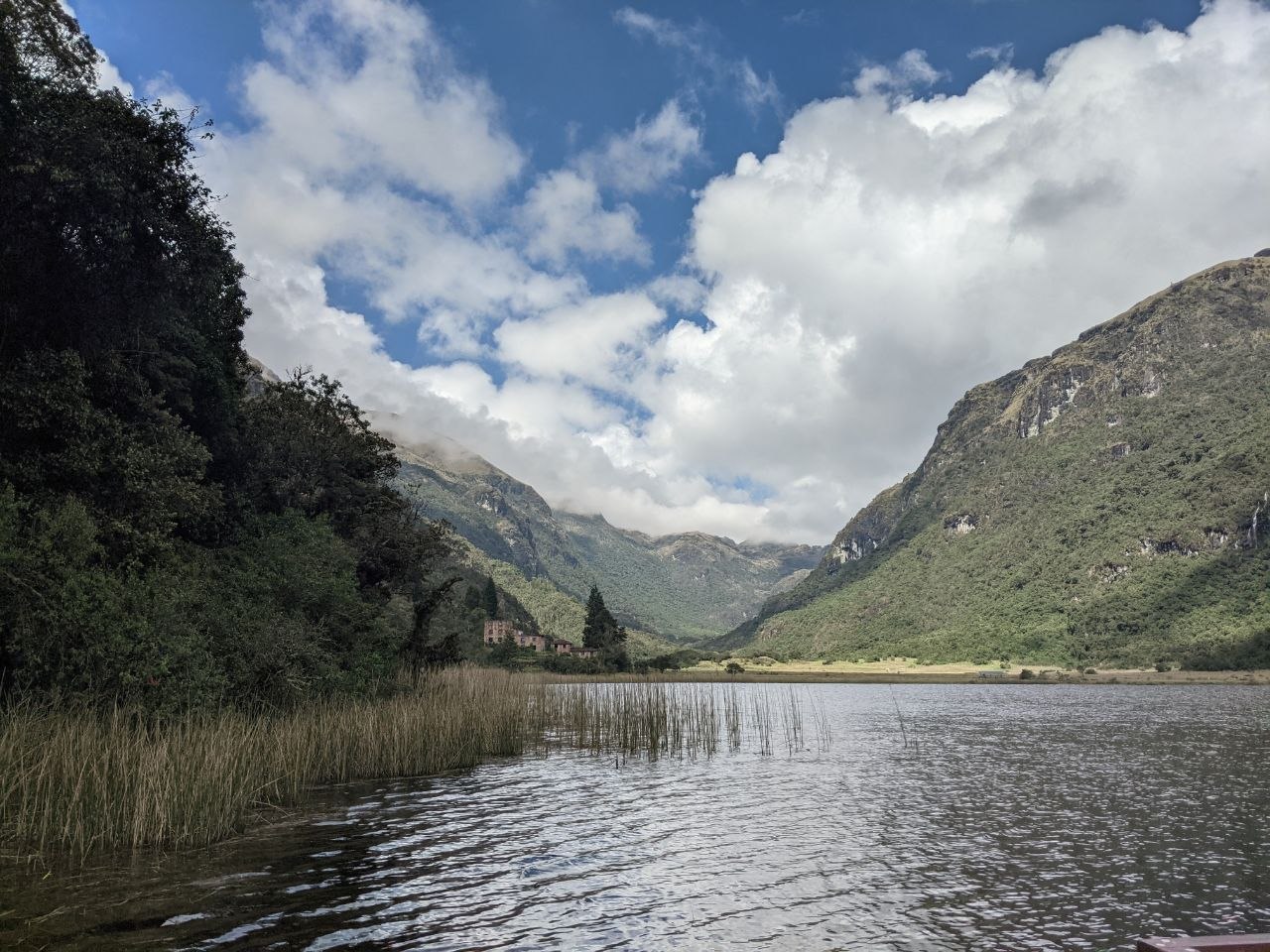
The defining feature of Cajas is its dense network of glacial lakes. Formed during the last ice age when glaciers carved hollows into the bedrock, the lakes range from small, reed-fringed ponds to broad, deep lagoons framed by jagged Andean peaks. The water is cold and remarkably clear, reflecting the shifting cloud patterns overhead. Larger lakes such as Laguna Toreadora and Laguna Llaviucu sit near the main park entrance and are easily accessible, while dozens of smaller tarns are scattered across the interior, visible from elevated trail sections. The lakes also support populations of rainbow trout — introduced in the 20th century — and are used for catch-and-release fishing within designated areas.
Páramo Ecosystem
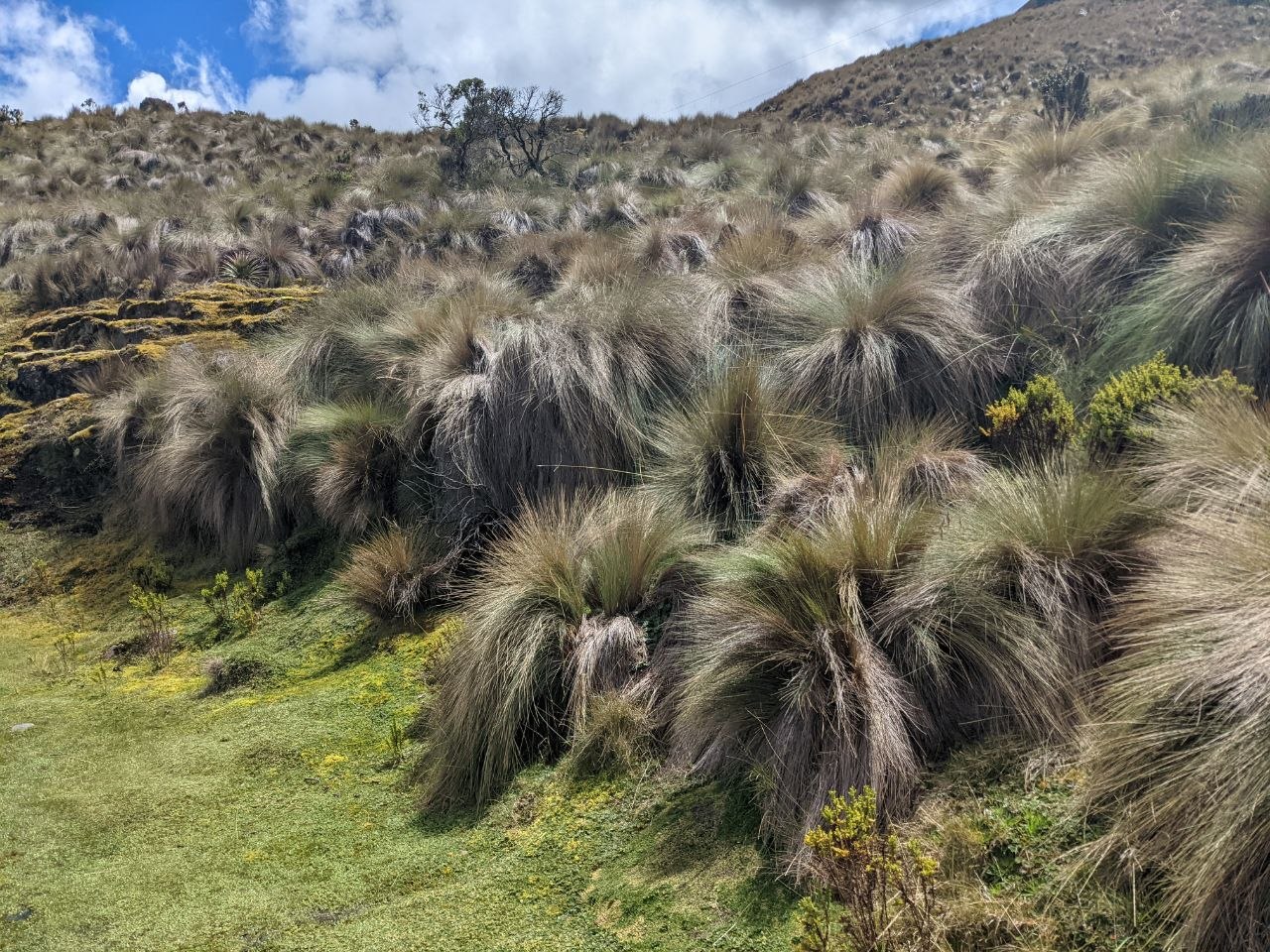
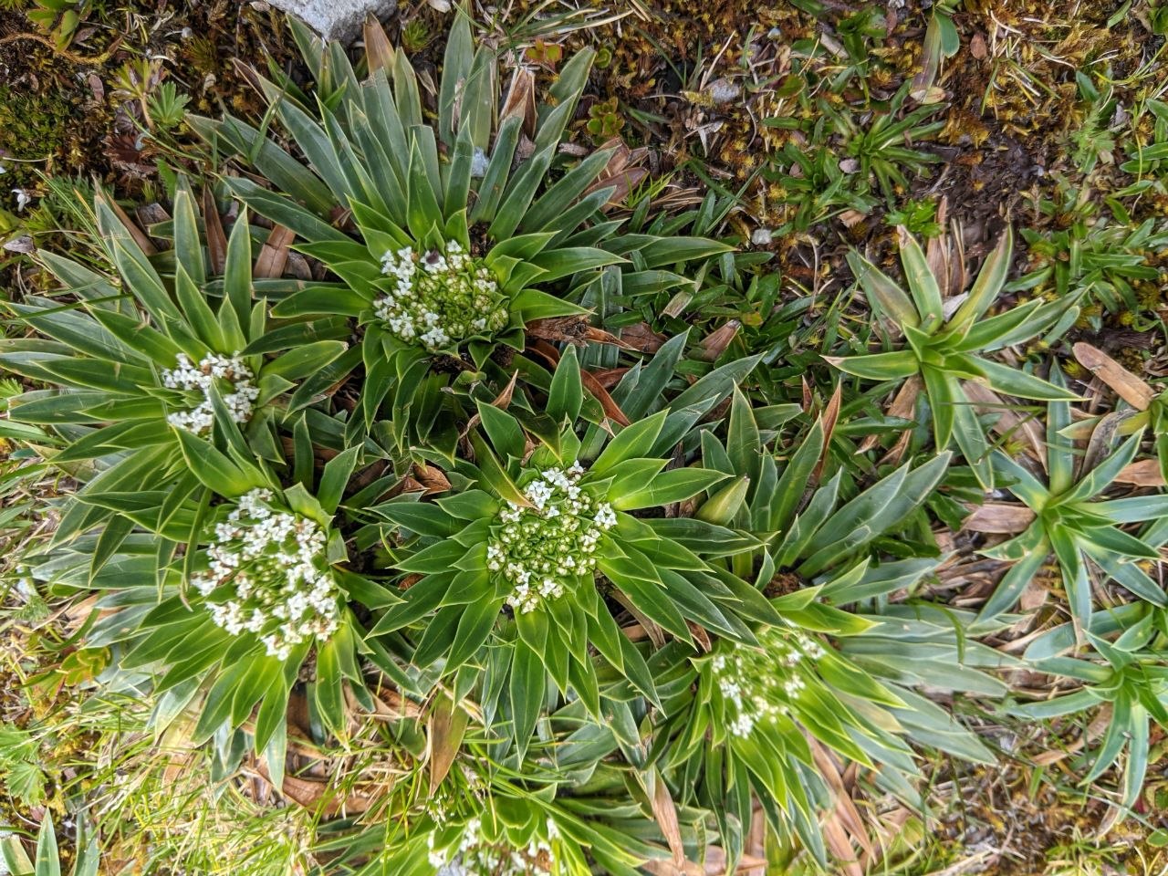
The dominant landscape of Cajas is páramo — the high-altitude grassland ecosystem of the tropical Andes, found between the tree line and the permanent snowline. Tufted ichu grass covers the rolling hillsides, interspersed with cushion plants, mosses, and low-growing flowering species adapted to the intense UV radiation and cold temperatures at altitude. Among the most distinctive plants found in Cajas is the Valeriana species — compact rosette plants with small white flower clusters that grow close to the ground — as well as various species of orchid and Gentiana. The páramo of Cajas acts as a natural sponge, absorbing rainfall and releasing it slowly into the watershed that supplies Cuenca’s drinking water.
Polylepis Forest and Wildlife
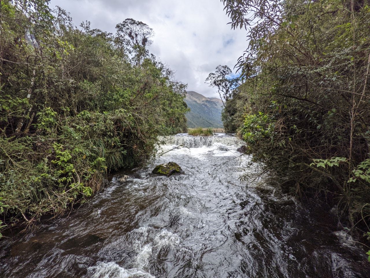
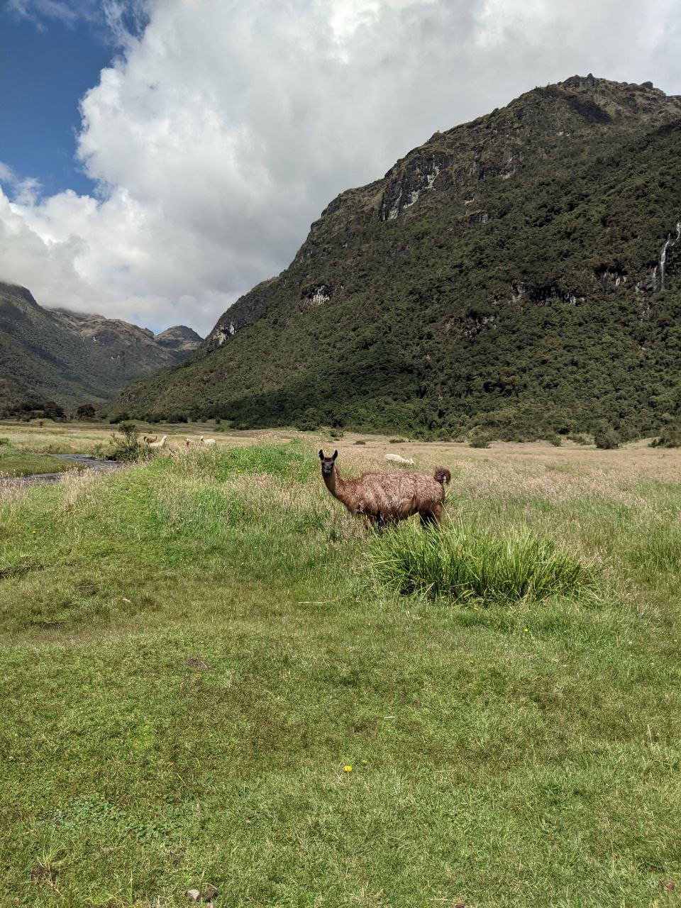
In sheltered valleys and along stream corridors, patches of polylepis forest survive — the highest-altitude forest type in the world, with gnarled, red-barked trees draped in mosses and lichens. Rivers and streams flow swiftly through these lower sections of the park, fed by the lakes above. Cajas supports a diverse range of wildlife adapted to high-altitude conditions, including the Andean condor, carunculated caracara, and numerous species of hummingbird and duck. Llamas and alpacas graze in the lower valley floors, where green meadows open out beneath steep, cloud-forest-covered mountain walls.
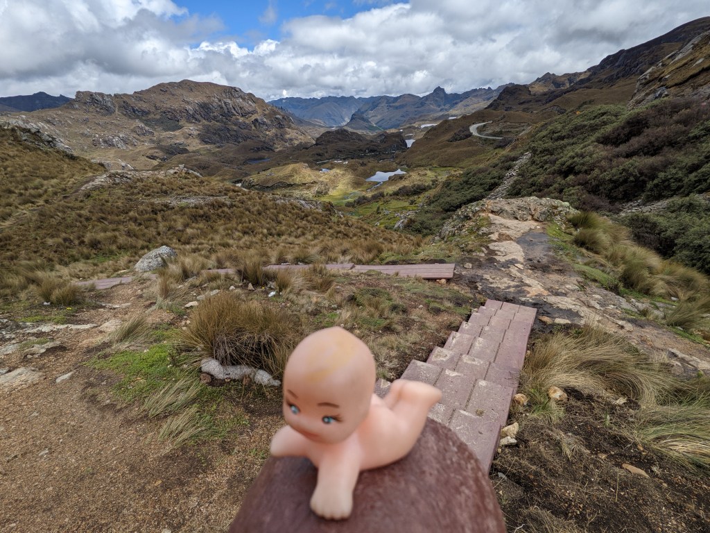
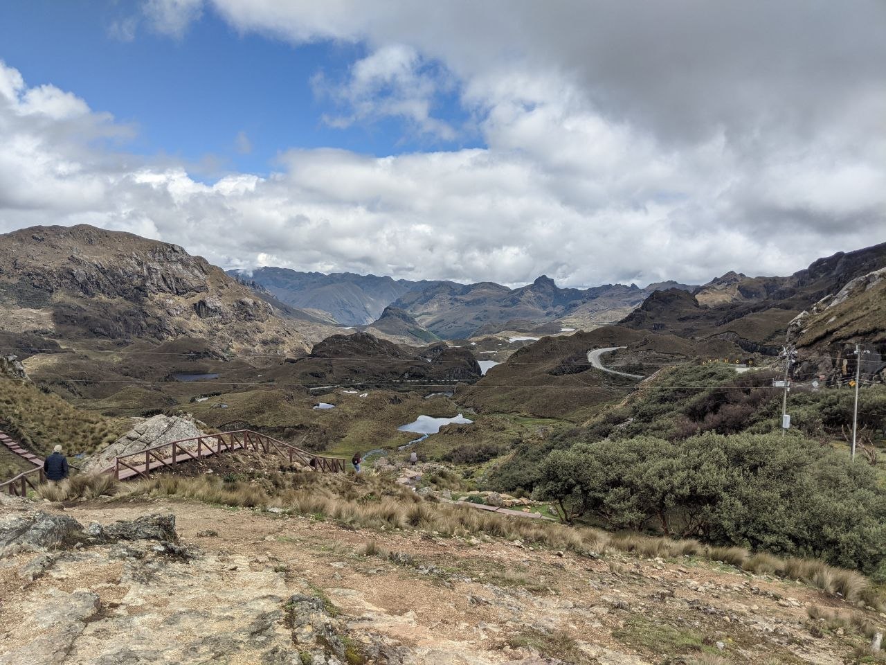
Mirador Tres Cruces
One of the most accessible viewpoints in the park is Mirador Tres Cruces, located near the main visitor centre along the Cuenca–Guayaquil highway. A wooden boardwalk and staircase lead up from the road to a high point overlooking the central lake basin, with panoramic views stretching across multiple lagoons, rocky outcrops, and the park’s characteristic undulating terrain. On clear days the views extend deep into the park interior, revealing the scale of the landscape. The site takes its name from three crosses that historically marked the continental divide — the point from which water drains either to the Pacific or to the Amazon basin.
Visiting Tips
Cajas National Park is accessible from Cuenca by taxi or the Guayaquil-bound bus, which passes through the park and stops at the main visitor centre near Laguna Toreadora — a journey of approximately 45 minutes. The park is open daily and an entrance fee is required. Weather at altitude is highly unpredictable; clear mornings can give way to fog, wind, and rain within hours. Warm, waterproof layers are essential regardless of season. Altitude sickness is a consideration, particularly for those arriving directly from sea level — acclimatisation in Cuenca for a day or two beforehand is recommended. Trails are well-marked and range from short lakeside walks to full-day hikes across the interior. A park map is available at the visitor centre.

Leave a comment