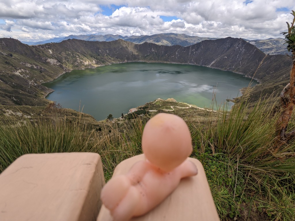
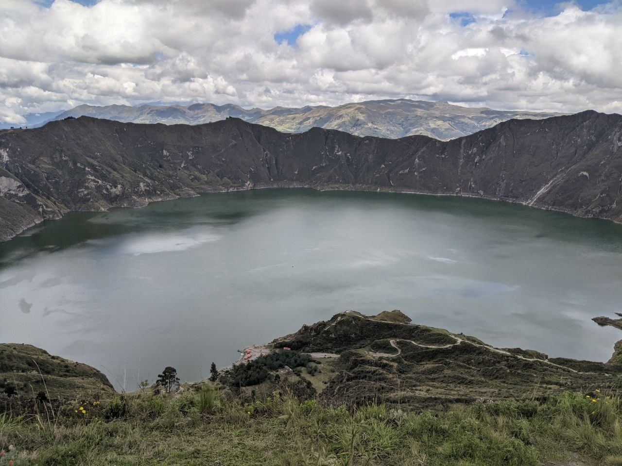
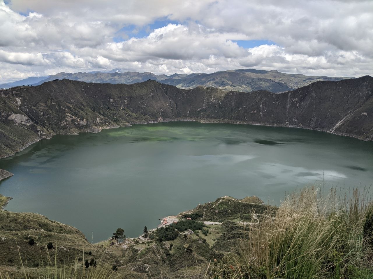
Laguna Quilotoa is a water-filled volcanic caldera located in the Cotopaxi Province of central Ecuador, at an elevation of approximately 3,914 metres above sea level. The lake sits at the collapsed summit of Quilotoa, a stratovolcano last active around 1280 CE, and is one of the most visited natural landmarks in the Ecuadorian Andes. The crater measures roughly 3 kilometres across, and the lake within it reaches depths of up to 250 metres. Its distinctive blue-green colour — caused by dissolved minerals — is visible from the crater rim on clear days.
Volcanic Origins
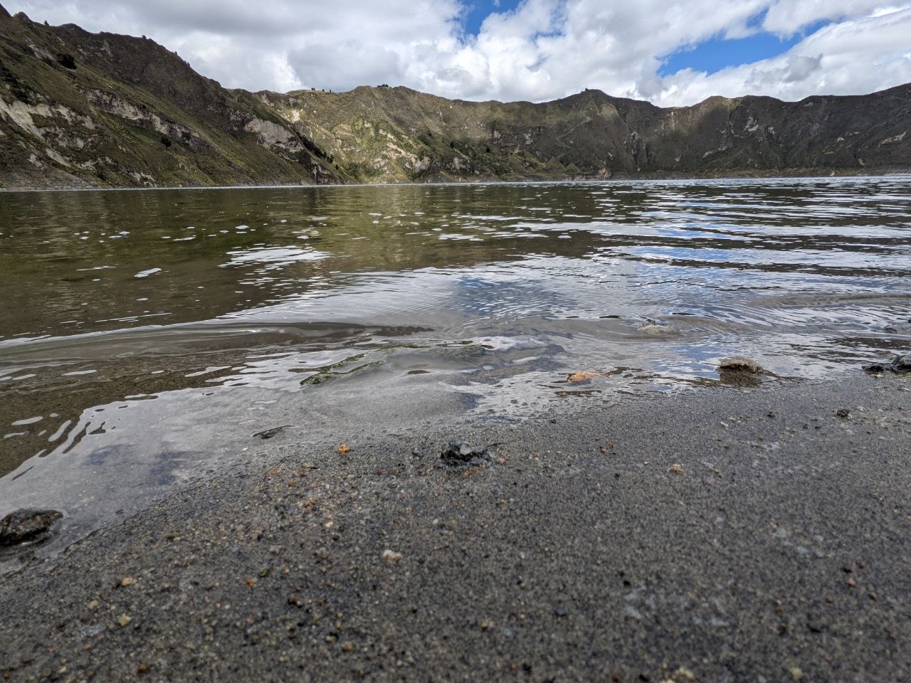
Quilotoa is a dacite stratovolcano, part of the chain of volcanoes running along Ecuador’s Avenue of the Volcanoes. The caldera was formed by a major eruption approximately 800 years ago, which deposited ash as far as the Pacific coast and collapsed the summit into its current bowl shape. Subsequent rainfall and hydrothermal activity filled the crater over centuries, creating the lake that exists today. The surrounding landscape is composed of dark volcanic rock and compacted ash, and the black sand shoreline at the water’s edge reflects the mineral-rich geology of the crater floor.
The Crater Lake
The lake surface sits roughly 300 metres below the crater rim and spans the full width of the caldera. The water shifts in tone depending on the light and weather — ranging from a deep jade green to a pale turquoise — owing to high concentrations of dissolved minerals including sulphur. The shoreline is composed of dark volcanic black sand and loose rock, and a small shelter and kayak rental operation operates at the water’s edge. The lake is not recommended for swimming due to the mineral content and cold temperatures, but the shoreline itself is a striking destination after the descent.
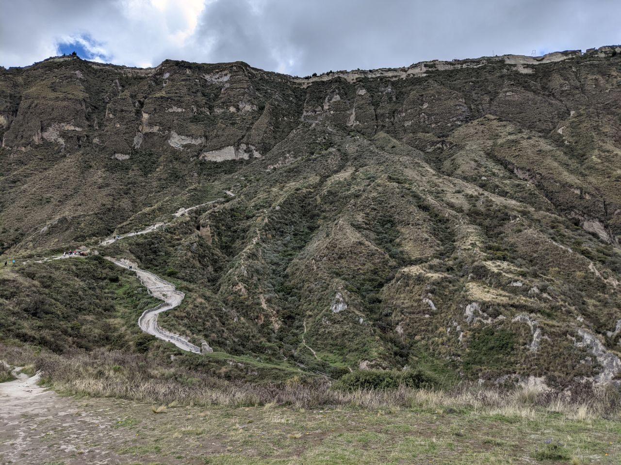
The Descent Trail
From the crater rim village of Quilotoa, a steep trail zigzags down the inner caldera wall to the lake. The descent takes approximately 30–45 minutes on foot and drops around 300 metres in elevation over loose, gravelly terrain. The trail is well-worn and clearly marked, though it becomes steep in sections. The return ascent is significantly more demanding — taking 1.5 to 2 hours on foot — and mules are available for hire at the lakeside for those who prefer not to climb back up on their own. The altitude makes exertion noticeably harder than at lower elevations.
The Crater Rim
The rim of the Quilotoa caldera offers sweeping 360-degree views across the Andean highlands. The walk around the full rim circuit covers approximately 9 kilometres and takes 4–5 hours at a relaxed pace. Much of the rim is covered in páramo — the high-altitude grassland ecosystem of the Andes — with tufted grasses and low-growing plants framing views of the lake far below. On clear days, surrounding volcanoes including Cotopaxi and Ilinizas are visible on the horizon. Even a short walk along the rim from the main viewpoint reveals the full scale of the caldera.
Visiting Tips
The village of Quilotoa is accessible by bus from Latacunga (approximately 2 hours), which in turn is reachable from Quito in around 2 hours by bus or car. The crater rim sits at nearly 4,000 metres — acclimatisation to altitude is strongly recommended before attempting the descent and ascent. Morning visits offer the clearest views; clouds frequently roll in during the afternoon. Warm layers are essential regardless of season, as temperatures at the rim can drop sharply. Entrance to the crater area carries a small fee collected at the village. Mules for the return ascent from the lake can be hired at the shoreline.

Leave a comment