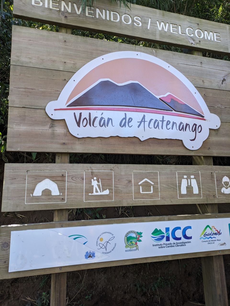
Acatenango is a dormant stratovolcano in Guatemala’s Central Highlands, rising to 3,976 metres above sea level and ranking among the country’s highest peaks. Towering over the colonial city of Antigua, it forms part of the Sierra Madre de Chiapas and sits within a chain of volcanoes that define the region’s skyline. Its broad slopes and high elevation offer expansive views across the Guatemalan highlands and the Pacific lowlands beyond.
Today, Acatenango is best known as one of Central America’s most popular overnight treks, drawing hikers who camp high on its upper flanks to watch the neighbouring Volcán de Fuego. From Acatenango’s high camp, Fuego’s near-continuous eruptions produce an unforgettable display of lava flows, glowing rock, and ash columns that rise dramatically into the sky.
The Trek
The ascent of Acatenango typically begins in the village of La Soledad, a short drive from Antigua, and follows a steep, demanding trail that takes around 8–10 hours for the round trip. Most routes gain more than 1,500 metres of elevation, making the climb physically challenging even for fit hikers, especially at higher altitudes where the air is thinner and the temperature drops.
The lower slopes are characterised by small farms and coffee plantations, where the volcanic soil supports dense, productive crops. As the trail climbs, it enters cool pine forest and then transitions into cloud forest, with moss-draped trees, ferns, and frequent mists rolling through. Higher still, the vegetation thins into sparse alpine scrub and volcanic gravel, opening wide views towards Volcán de Fuego and the surrounding ranges as hikers approach the high camp at roughly 3,700 metres.
High Camp & the Sea of Clouds
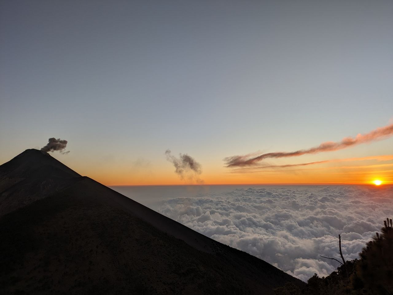
High camp on Acatenango is usually set just below the summit ridge, above the typical cloud line. From this vantage point, late afternoon often reveals a rippling sea of clouds filling the valleys below, with only the highest peaks emerging above the white blanket. As the sun descends, the silhouettes of nearby volcanoes—including Agua, Fuego, and distant peaks towards the Pacific coast—stand in sharp relief against the glowing sky.
Sunset is one of the defining moments of the Acatenango experience. The clouds shift and reform in the fading light, the horizon glows in layered tones, and the first hints of Fuego’s lava become visible as darkness falls. On clear evenings, the combination of stars overhead, clouds below, and erupting volcanoes on the horizon creates one of Guatemala’s most striking natural panoramas.
Volcán de Fuego
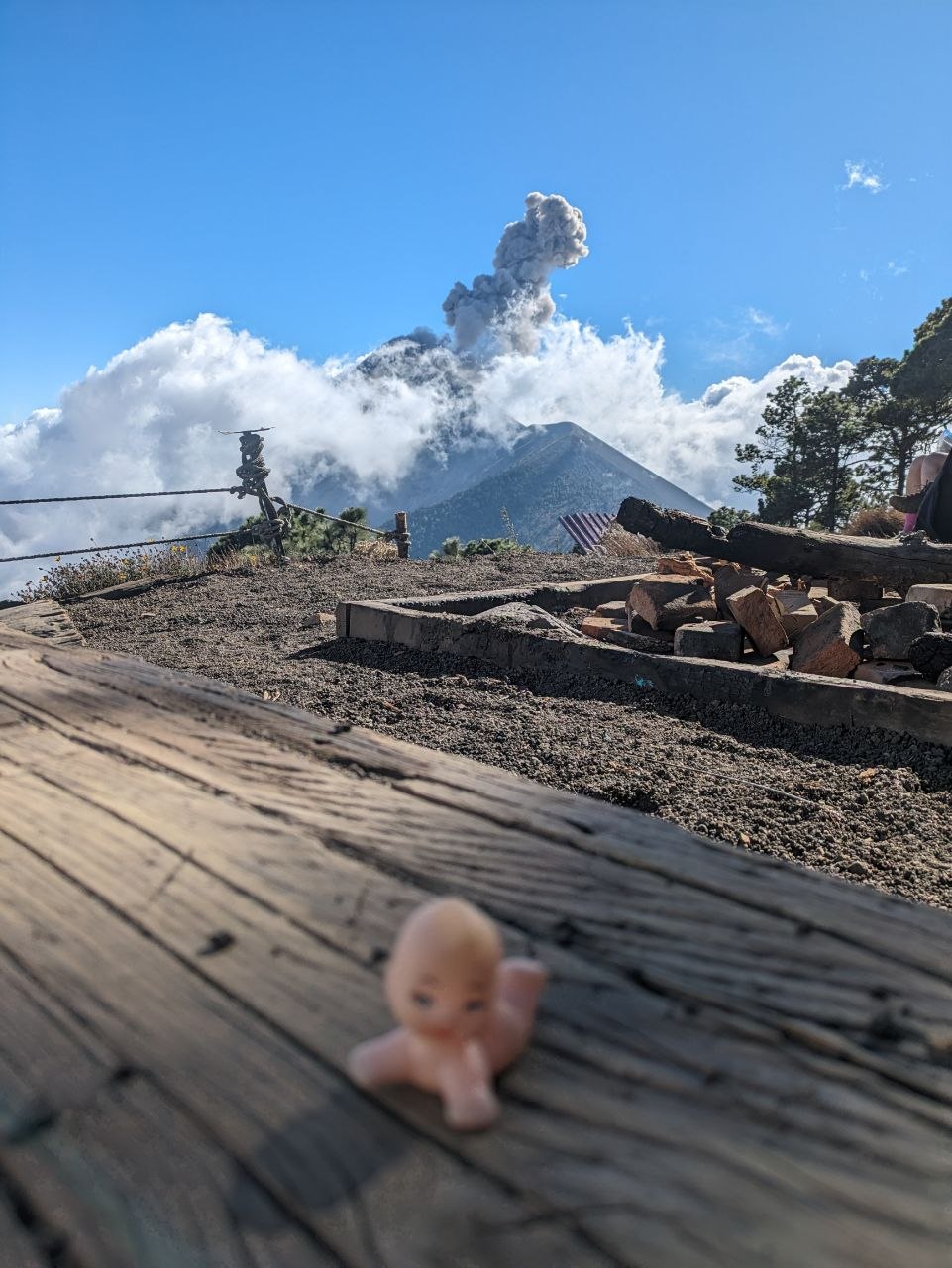
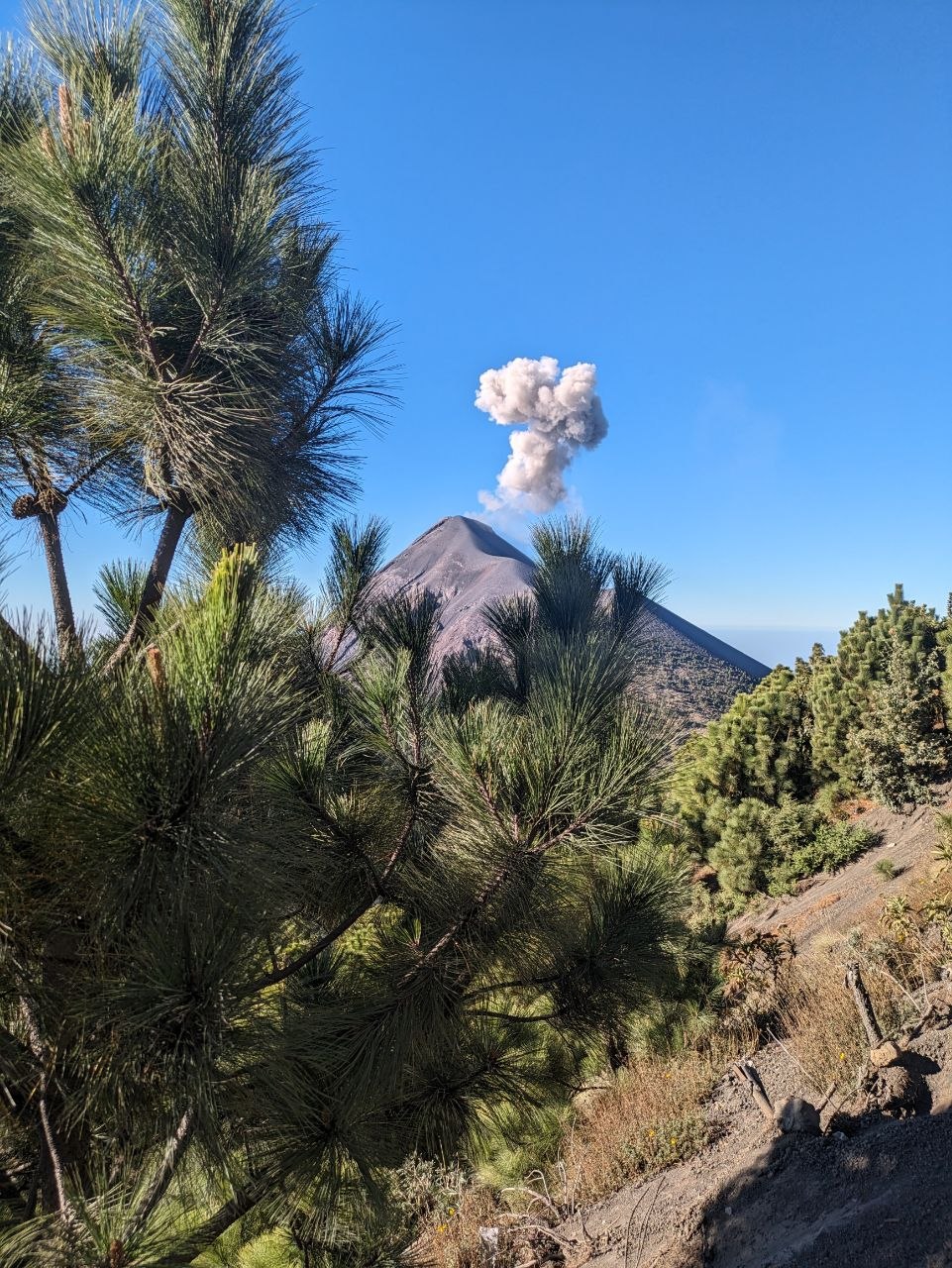
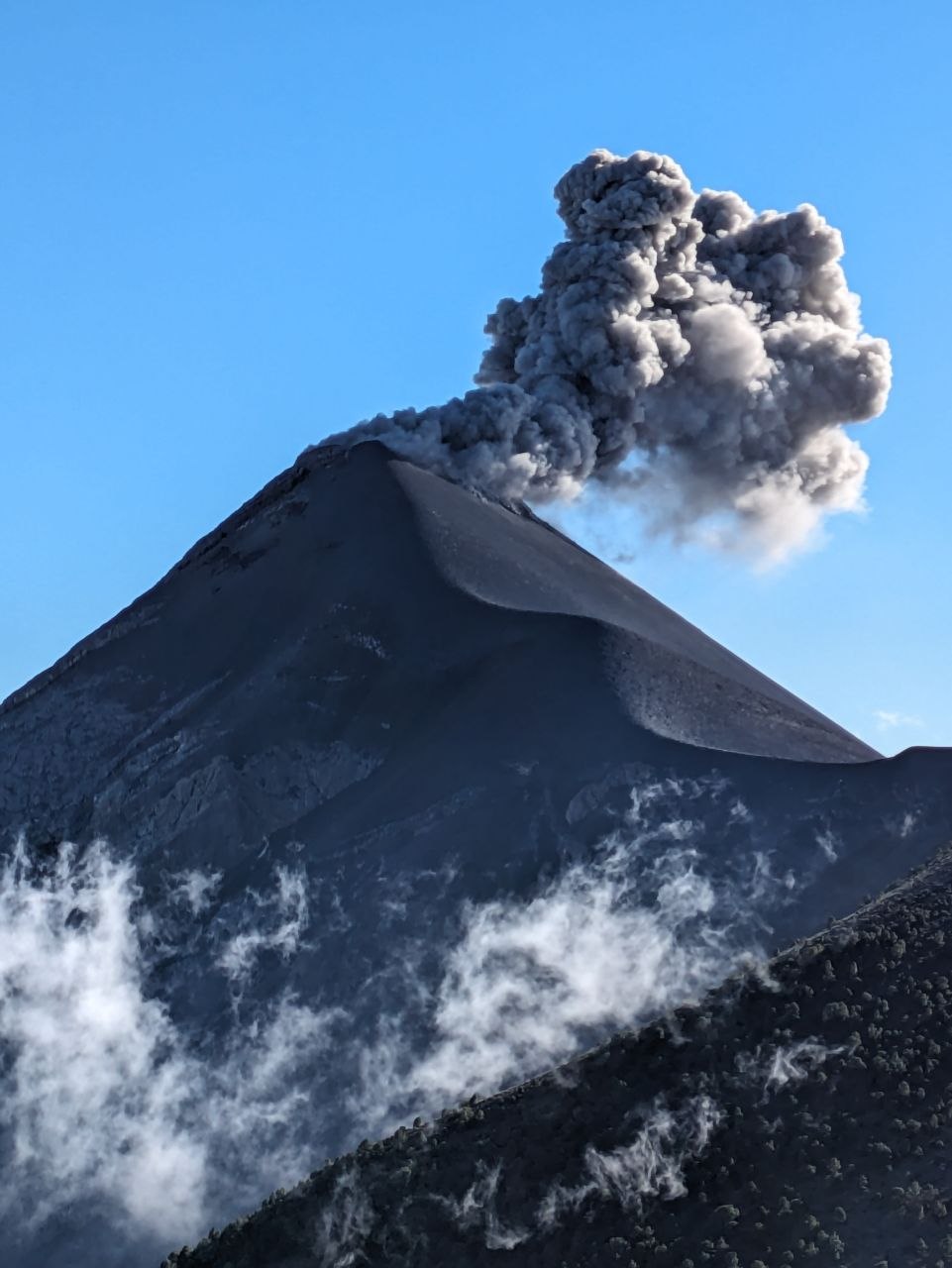
Volcán de Fuego, Acatenango’s immediate neighbour, is one of the world’s most active volcanoes. It erupts regularly, with explosions often occurring every 15 to 20 minutes, sending ash columns kilometres into the sky accompanied by thunderous booms that echo across the valleys. From Acatenango’s slopes and camp areas, these eruptions can be observed safely from a distance of roughly 2 kilometres.
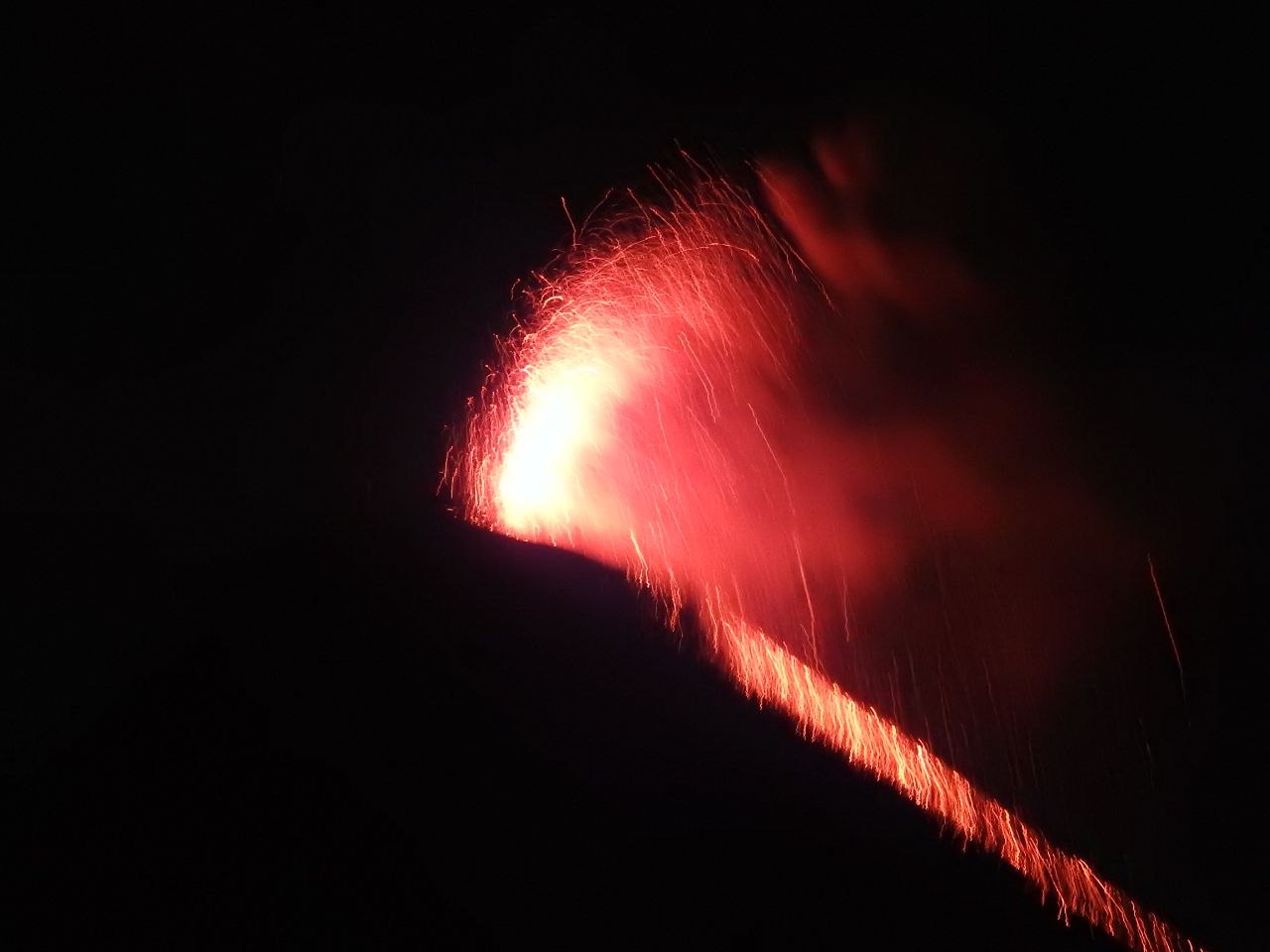
At night, Fuego’s activity becomes particularly dramatic. Jets of incandescent rock and continuous lava flows cascade down its flanks, illuminating the surrounding clouds and turning the sky a deep orange-red. Sparks and glowing fragments are visible in clear detail from camp, providing an extraordinary opportunity to witness an active stratovolcano in action from a secure vantage point.
The Summit
The final push from high camp to Acatenango’s summit crater typically takes 1–2 hours, often completed in the early morning to reach the top at or just after sunrise. The path climbs steep, loose volcanic gravel and follows the rim towards the highest point, where the air is thin and temperatures are often well below freezing. Despite the effort, the summit rewards hikers with one of the most expansive views in Guatemala.
From the 3,976-metre summit, there is a clear 360-degree panorama: the Pacific Ocean and coastal plains to the south, the volcanic chain and highlands of Guatemala stretching to the north and east, and the full profile of Volcán de Fuego directly across the saddle below. On clear days, the scale of Fuego’s eruptions and the surrounding landscape becomes fully apparent, highlighting Acatenango’s position at the heart of the Central American volcanic arc.
Visiting Tips
Guided overnight treks are the standard way to visit Acatenango, with tour operators based primarily in Antigua arranging transport, permits, meals, and camping equipment. Most groups hike to high camp on the first day, spend the night watching Volcán de Fuego, and then continue to the summit before sunrise on the second morning. Independent hiking is possible but less common, as local guides provide valuable route knowledge and safety oversight.
Conditions on Acatenango can be harsh, especially at night. Temperatures at high camp often drop below freezing, and strong winds are frequent, so visitors need warm layers, insulated jackets, hats, gloves, and adequate sleeping bags rated for low temperatures. The significant altitude gain and sleeping above 3,500 metres mean there is a risk of altitude sickness; a gradual pace, good hydration, and awareness of symptoms are important for a safer ascent.
Visibility is generally best during the dry season from November to April, when clear skies and stable conditions increase the chances of unobstructed views of Fuego’s eruptions and the surrounding landscape. During the rainy season, clouds and precipitation are more common, making views less predictable and trails wetter and more slippery.

Leave a comment