The route north from Dakar towards Saint-Louis threads between two of Senegal’s most distinctive landscapes. Inland, the Lompoul Desert appears as a compact pocket of Saharan-style dunes, a burnished-orange world of sand rising abruptly from the surrounding scrub. Further north, at the mouth of the Senegal River, Saint-Louis occupies a narrow island linked by bridges to the mainland and the Atlantic sandbar of the Langue de Barbarie. Together, the dunes of Lompoul and the historic streets of Saint-Louis trace a journey from desert quiet to riverine city in a single day’s drive.
Although modest in scale compared with the vast Sahara further north, Lompoul offers a concentrated experience of desert topography within a few hours of Dakar, with accessible dunes, organised camps and clear night skies. Saint-Louis, by contrast, is defined by its layered history and river setting, with colonial-era architecture, working quays and busy fishing beaches reflecting centuries of trade and migration along the West African coast.
Lompoul Desert
The Lompoul Desert is a compact but dramatic expanse of orange sand dunes located roughly 180 kilometres north of Dakar, close to the Atlantic coast. The dune field forms an isolated enclave of Saharan landscape set between the ocean and the main road to Saint-Louis, bordered by low scrub and villages. Unlike the continuous dunes of the greater Sahara, Lompoul is an intimate desert: its sand hills typically rise to around 100 metres, allowing wide views across the surrounding plateau and out towards the coast.
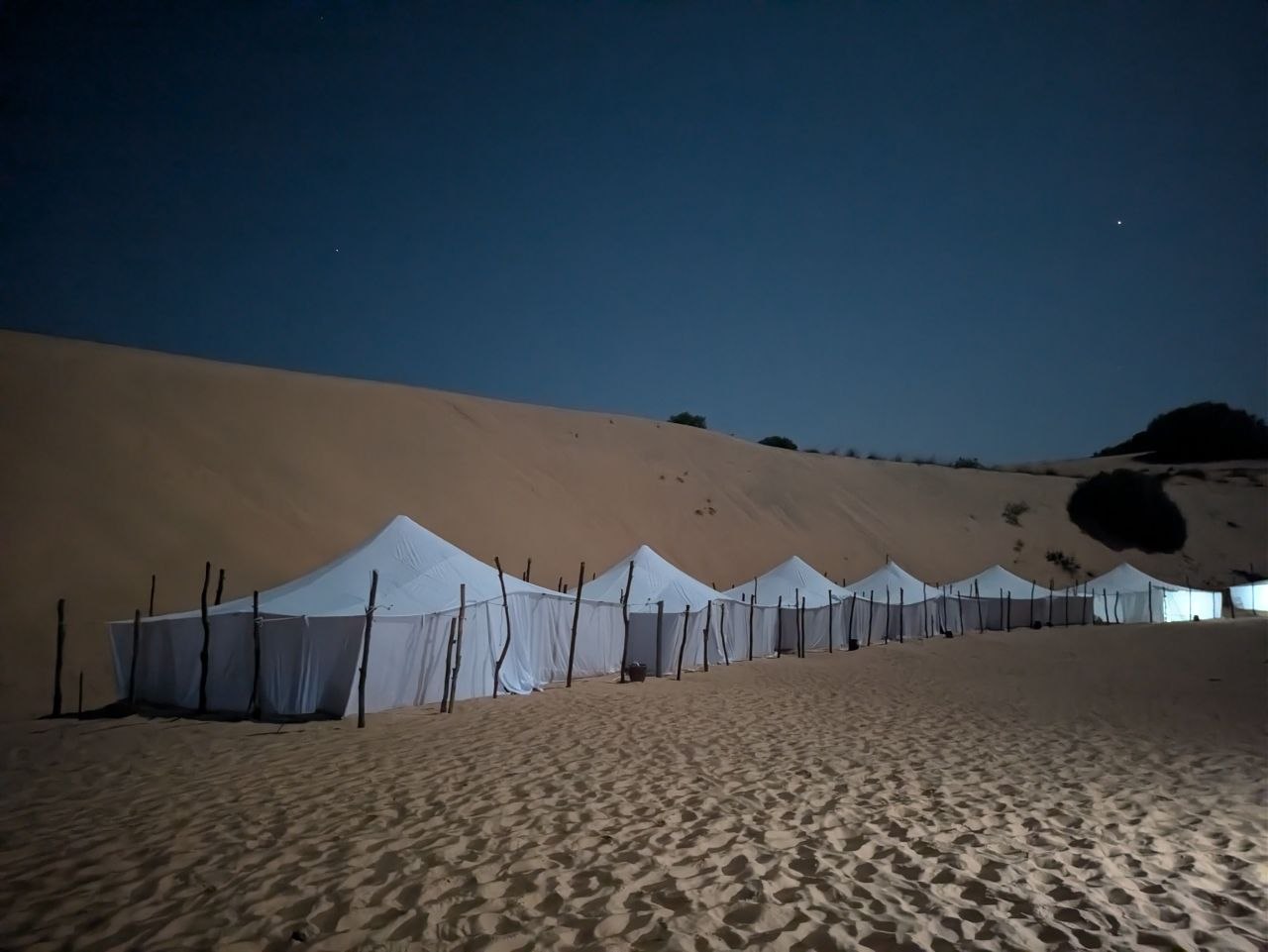
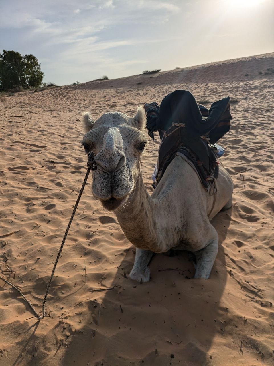
Overnight camps are set among the dunes, often using Mauritanian-style tents arranged around communal areas for meals and music. Access is usually by 4×4 from the nearest paved road, with the final approach crossing soft sand. Camel rides at sunrise or sunset are the signature activity, tracing ridgelines as the low light accentuates the curves of the dunes. Away from camp generators, the desert offers dark skies and a clear sense of isolation, with wind patterns and shifting sand constantly reshaping the landscape.
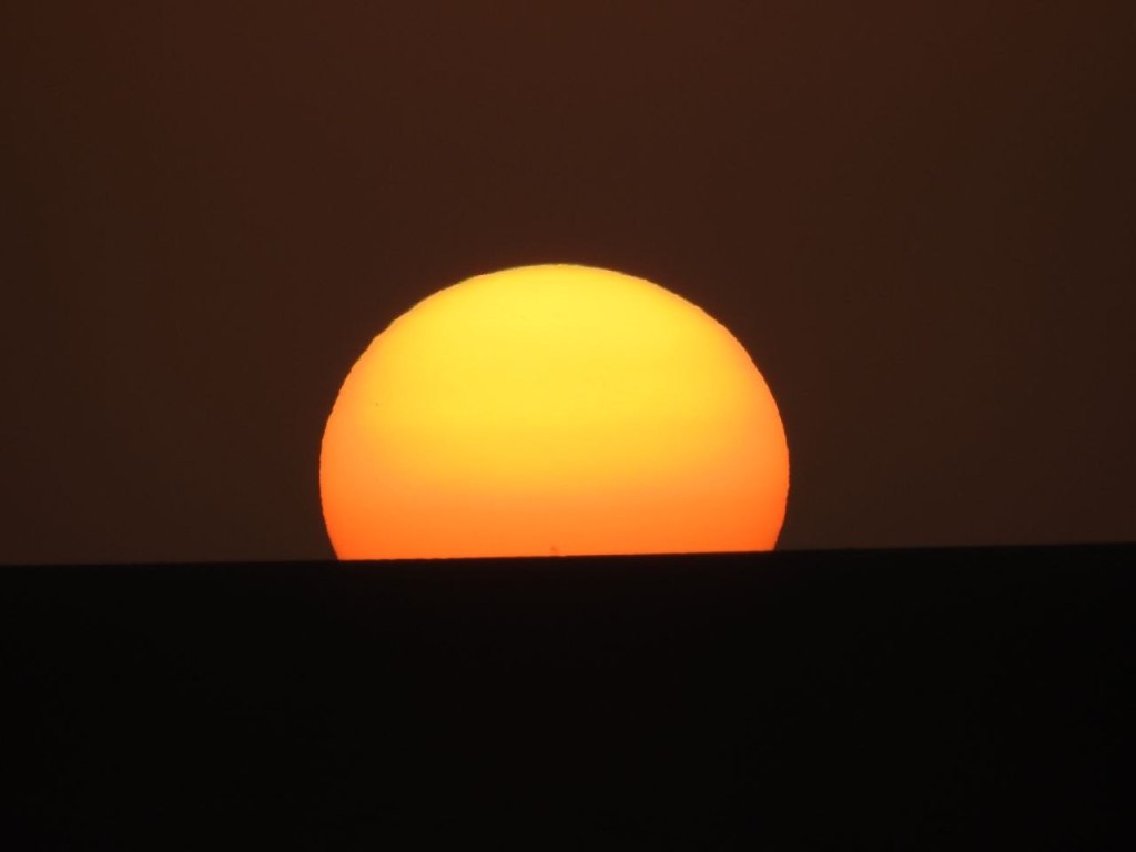
Golden hour is the defining moment at Lompoul. As the sun drops towards the Atlantic, the colour of the sand deepens from pale beige to intense orange, and long shadows highlight the ripples sculpted by the wind. The combination of soft light, clean horizons and minimal vegetation makes this one of Senegal’s most striking natural settings for photography and quiet observation.
Saint-Louis
Founded by the French in 1659, Saint-Louis — known locally as Ndar — was the first permanent French settlement in sub-Saharan Africa. For more than two centuries it served as a key administrative centre, becoming the capital of French West Africa before the colonial administration moved to Dakar in 1902. The city developed on a long, narrow island in the Senegal River, chosen for its strategic position and relative protection from Atlantic swells.
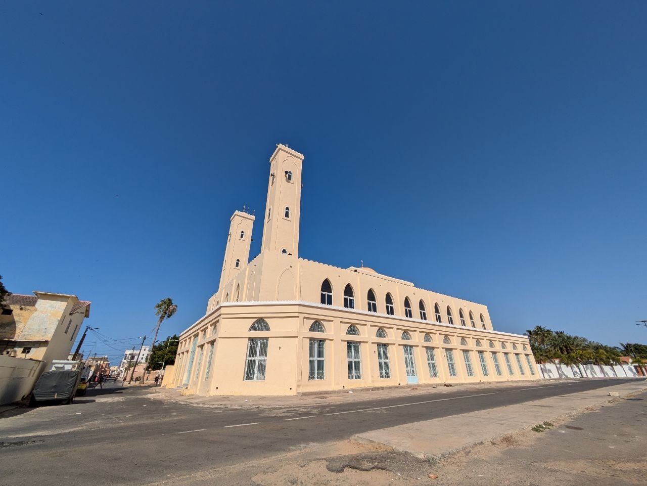
The historic core of Saint-Louis is laid out on a simple grid of streets, its urban fabric dominated by two- and three-storey buildings with pastel facades, wooden shutters and wrought-iron balconies. Former warehouses, merchants’ houses and administrative buildings line the quays facing the river, while religious and civic structures punctuate the skyline with towers, cupolas and minarets. This combination of European colonial architecture adapted to a Sahelian climate, and the city’s ongoing role as a regional hub, led to its inscription as a UNESCO World Heritage Site in 2000.
Today, Saint-Louis is both a living city and an open-air record of coastal West African history. Markets, workshops and schools occupy the ground floors of many historic buildings, while the riverfront remains a working space for transport, small-scale trade and fishing. The coexistence of heritage and contemporary daily life is central to the atmosphere of the island and its surrounding neighbourhoods.
Faidherbe Bridge
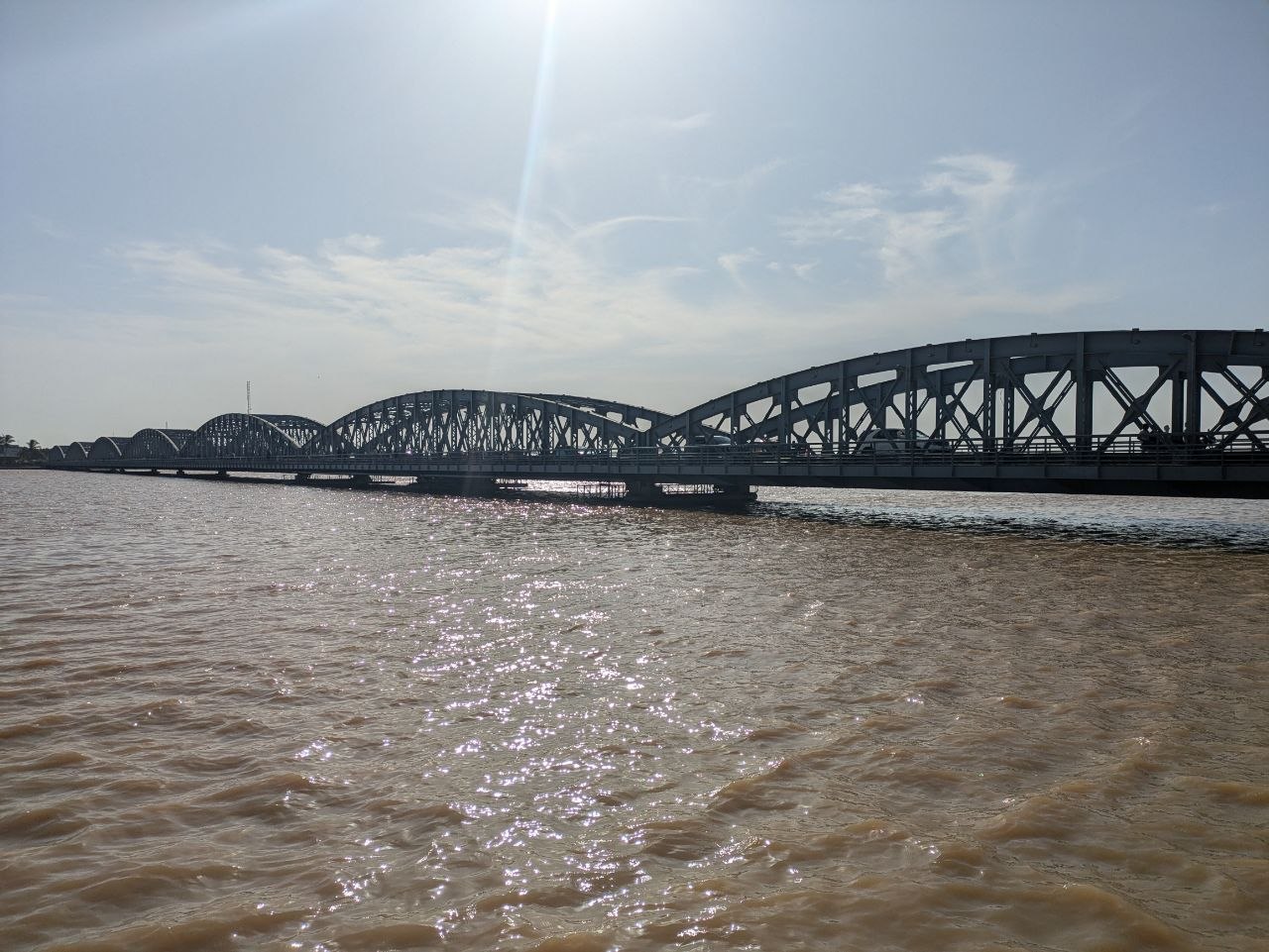
The Pont Faidherbe is the most recognisable structure in Saint-Louis. Completed in 1897, this 507-metre iron bridge spans the Senegal River, linking the island city to the mainland at Sor. Originally designed for Cairo, the prefabricated metal sections were ultimately redirected to Saint-Louis, where the bridge became a crucial piece of infrastructure for trade and administration across the river delta.
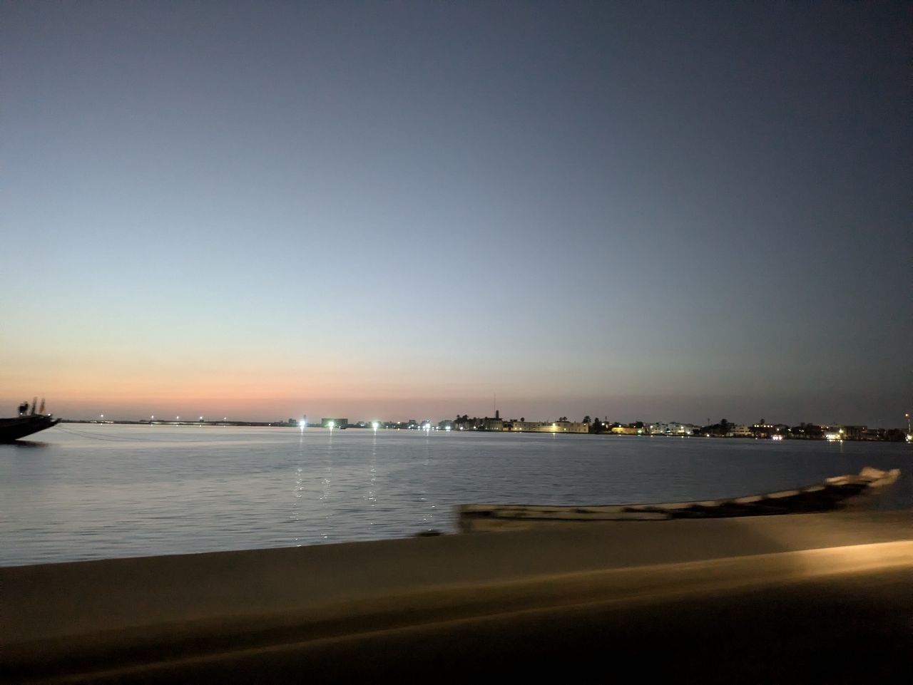
The bridge’s steel arches form a repeating pattern across the water, with a central section that was historically movable to allow larger vessels to pass. While road upgrades elsewhere in Senegal have altered traffic patterns, the Pont Faidherbe remains a functional crossing and an enduring symbol of the city. Its silhouette against the river at dusk, with reflections rippling on the surface below, is one of Saint-Louis’s most photographed views and a key reference point for orientation within the city.
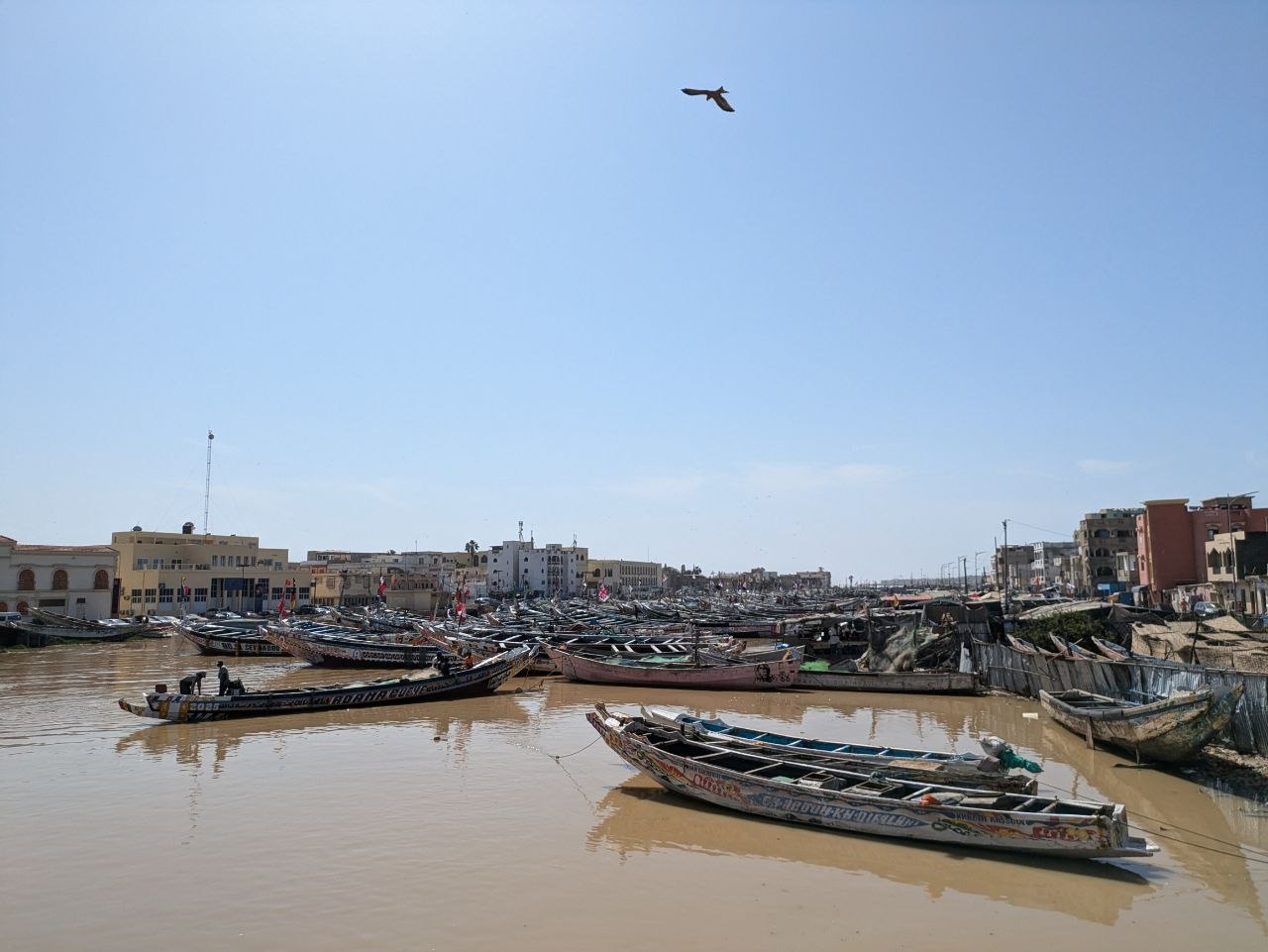
The Fishing Pirogues
To the west of the island, the Langue de Barbarie forms a long, narrow sandbar peninsula separating the Senegal River from the Atlantic Ocean. This strip of land hosts one of Senegal’s most active fishing communities, with villages and urban neighbourhoods positioned close to both river and sea. Here, hundreds of brightly painted wooden pirogues are drawn up on the beach and lined along the riverbanks, their hulls marked with names, symbols and geometric patterns.
The Saint-Louis fishing fleet is among the largest artisanal operations in West Africa. Each day, boats are launched through the surf or into the river at first light, returning later with catches that feed local markets and supply traders inland. On shore, crews sort and unload fish, repair nets and maintain the boats, often repainting hulls in vivid colours that stand out against the sand and water. This constant cycle of launching, landing and maintenance is one of the defining sights and sounds of the city’s waterfront.
Fishing activity extends beyond the shoreline into processing areas where fish are smoked, dried or salted for preservation. The resulting combination of boat traffic, stacked nets, improvised drying racks and busy marketplaces underscores Saint-Louis’s long-standing relationship with the Atlantic and the river, and its economic dependence on marine resources.
Street Food & Thiéboudienne
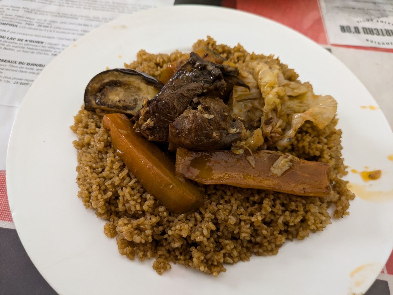
Senegal’s national dish, thiéboudienne, is closely associated with coastal cities such as Saint-Louis. The dish typically consists of rice cooked in a rich tomato-based broth with fish and vegetables, absorbing flavours from ingredients such as tamarind, preserved fish and a blend of spices. In Saint-Louis, the proximity of the fishing fleet ensures a steady supply of fresh fish, and the dish appears in homes, canteens and informal restaurants across the city.
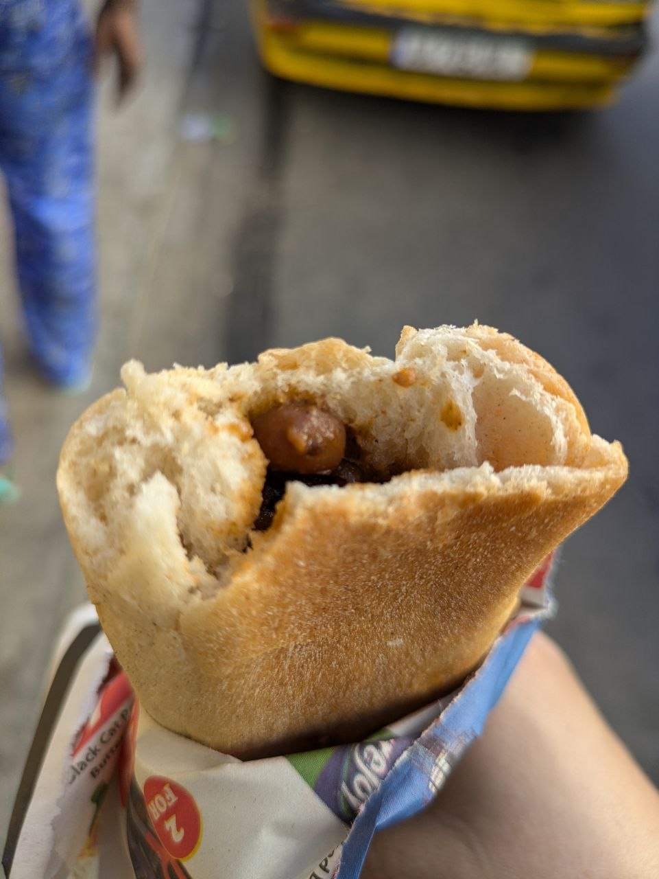
Along roads between Dakar, Lompoul and Saint-Louis, and within the cities themselves, street food stalls and small kiosks offer quick, filling options for travellers and local residents. One of the most common is ndambe: a Senegalese street food sandwich made with black-eyed pea stew stuffed into a baguette, often finished with onions, mustard or chilli sauce. These simple sandwiches are a staple of Senegalese street eating and reflect broader Maghrebi and Sahelian culinary influences along the corridor linking Dakar, Lompoul and the Senegal River valley.
Visiting Tips
Lompoul is best experienced as an overnight stop rather than a brief detour. Arriving in the late afternoon allows time to cross the dunes, watch sunset from a high ridge and see the colour of the sand change as the light softens. An early start the next morning provides the chance to experience the dunes at sunrise, when the air is cool, the sand unmarked by footprints and the low sun creates strong contrasts and long shadows.
The drive from Dakar to Saint-Louis typically takes around three to four hours on the main highway, depending on traffic and road conditions, with the turn-off to Lompoul located along this route. Many itineraries combine an overnight stay in the desert with onward travel to Saint-Louis the following day, creating a logical progression from dunes to river city.
Once in Saint-Louis, distances on the island are short and the historic centre is compact and walkable. Exploring on foot makes it easier to appreciate architectural details, river views and everyday street life, from markets and workshops to quiet residential lanes. The island also serves as a practical base for visiting nearby protected areas, including the Djoudj National Bird Sanctuary upstream on the Senegal River and the Langue de Barbarie National Park to the south, both important habitats for migratory and resident bird species.
Conditions in both Lompoul and Saint-Louis can be hot and bright, with reflective sand and water intensifying the sun. Lightweight clothing, sun protection and adequate drinking water are important year-round, while the dry season generally offers clearer skies for desert sunsets and coastal views.

Leave a comment